Top 10 scenic routes in Western Canada (with Maps + Photos)

Most road directions applications these days will trace you the quickest way from point A to point B.
But I strongly believe that a true canadian road trip should be about taking the time to fully embrace your surroundings.
Here is my top 10 scenic routes in the West. To be enjoyed without moderation !
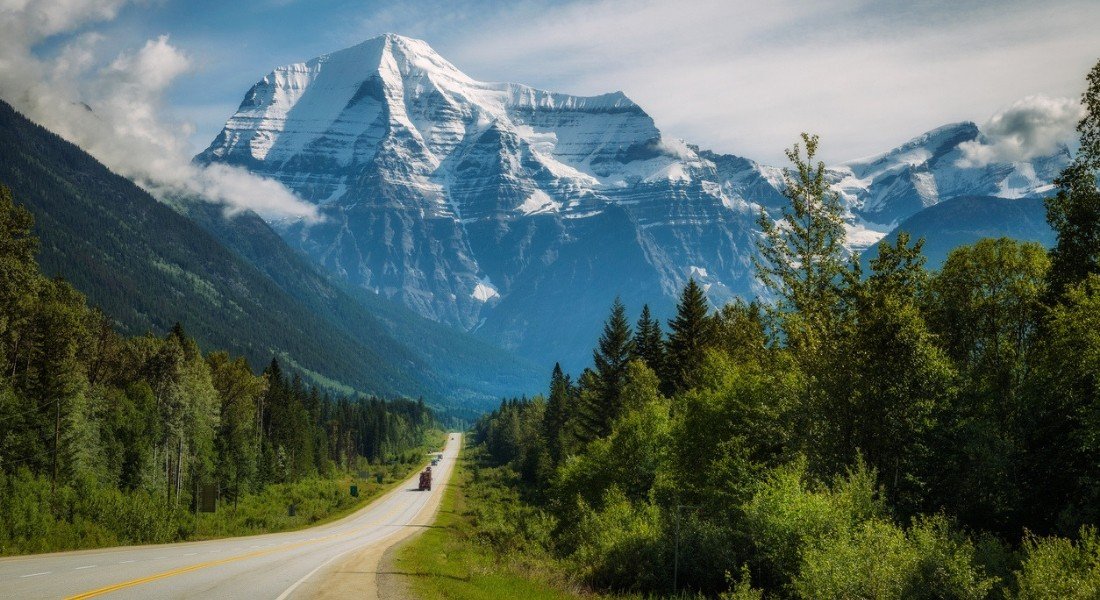
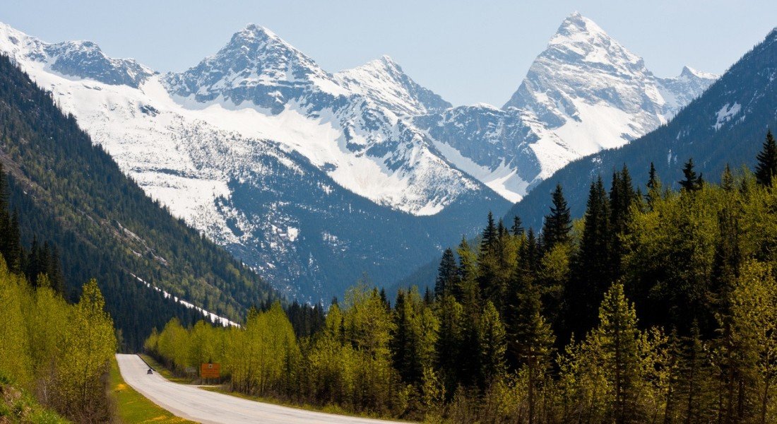
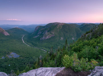
1. Icefields Parkway (Highway 93)
- Section: Jasper to Lake Louise
- Region: Jasper National Park and Banff National Park, Alberta
- Distance: 230 km
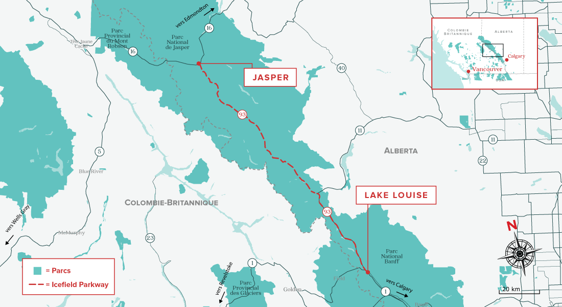
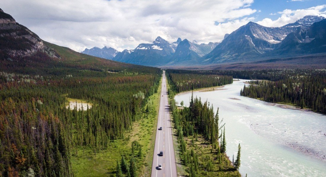
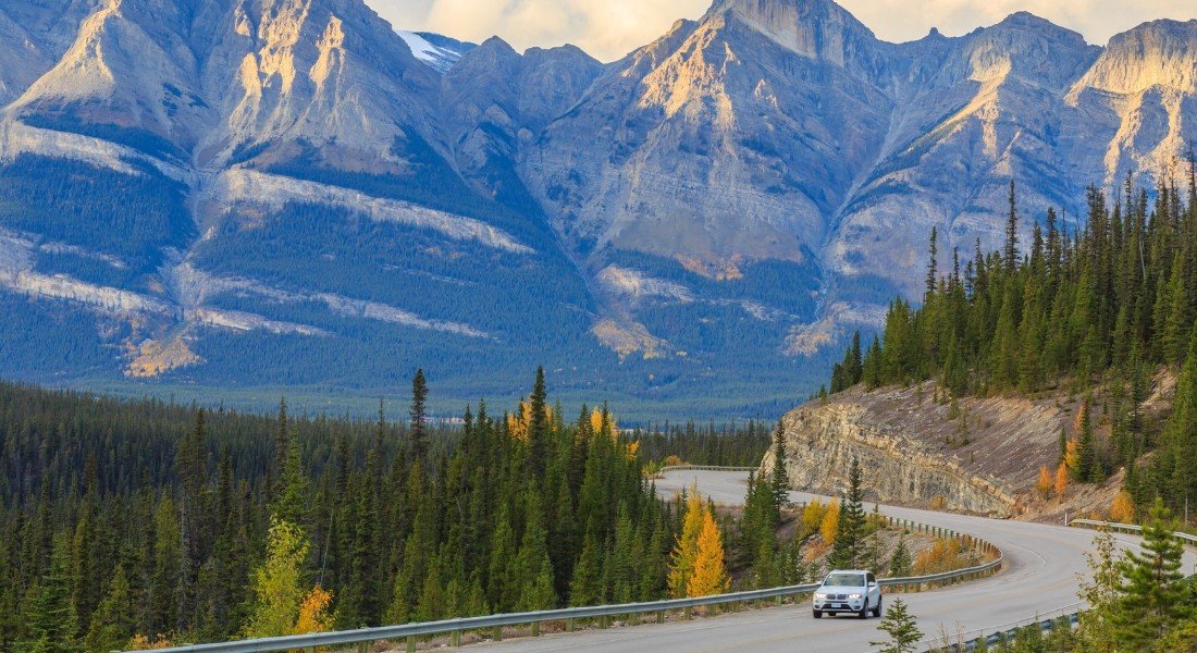
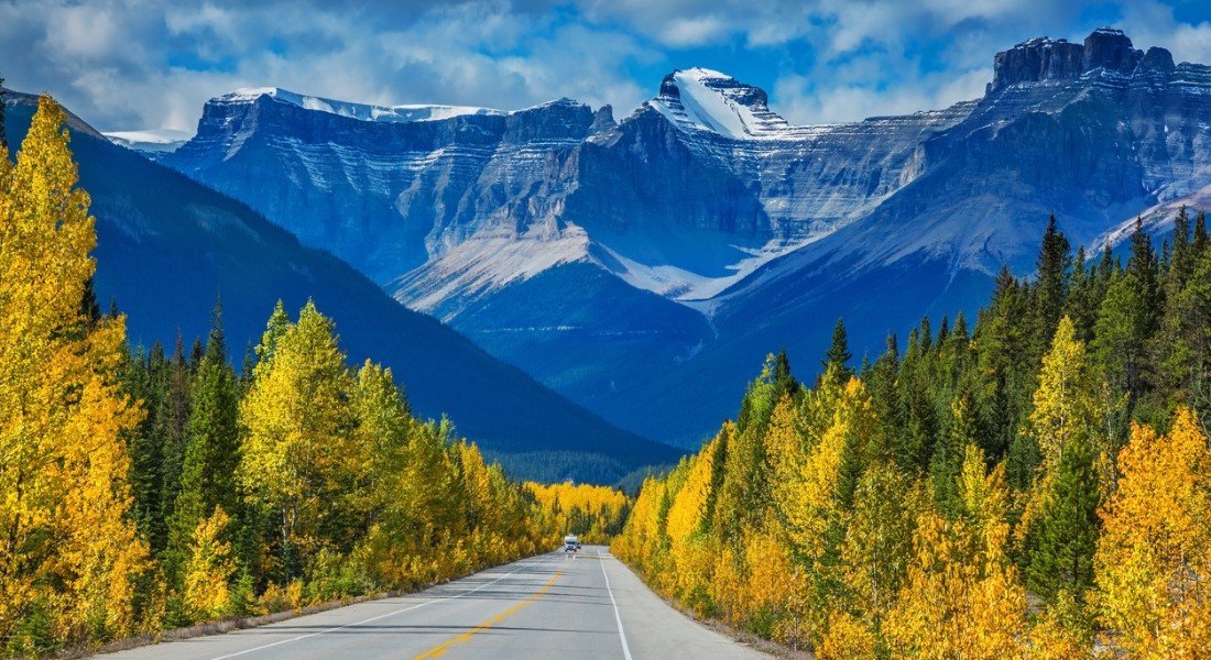
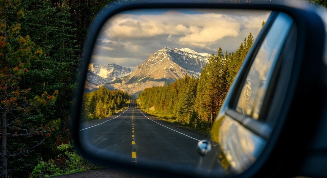


The legendary Icefields Parkway stretches from Jasper to Lake Louise, joining two of Canada's most popular national parks.
For nearly 80 years, it has wound its way between mountains, glaciers and turquoise lakes, providing travellers with access to some of the most stunning landscapes in Canada and earning itself a well-deserved place amongst the 10 most beautiful drives in the world. Every year, more than 1.2 million visitors drive this stretch of highway, enjoying the many points of interest along the way.
Natural sightseeings
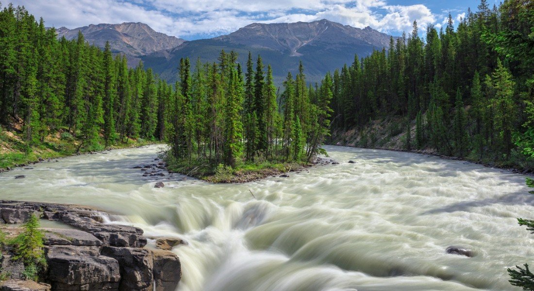
Your first stop is Athabasca Falls, 25 metres high, and accessible in less than 5 minutes. A must-see!
Then continue to Sunwapta Falls. A short 30-minute hike will lead you to another beautiful natural spectacle.
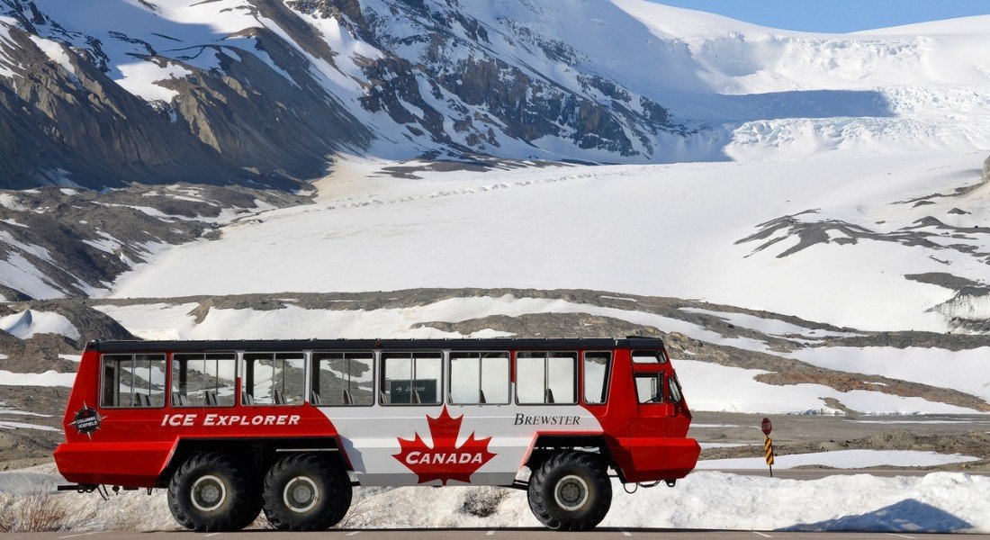
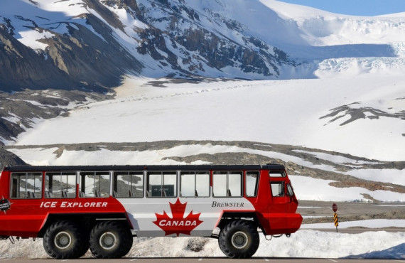
Time permitting, treat yourself to a guided tour of the Columbia Icefield that will take you to the top of the Athabasca glacier, where the ice can be up to 360 metres thick.
Turquoise wonders
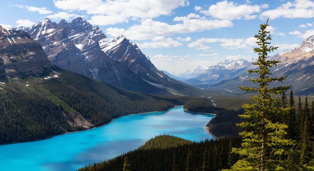
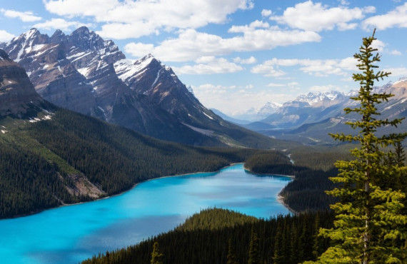
Back at the wheel, the next attraction you won't want to miss is Peyto Lake, which you can reach via a paved road. The contrast between the colour of the water, the pine forest and the snowy peaks will leave you speechless.
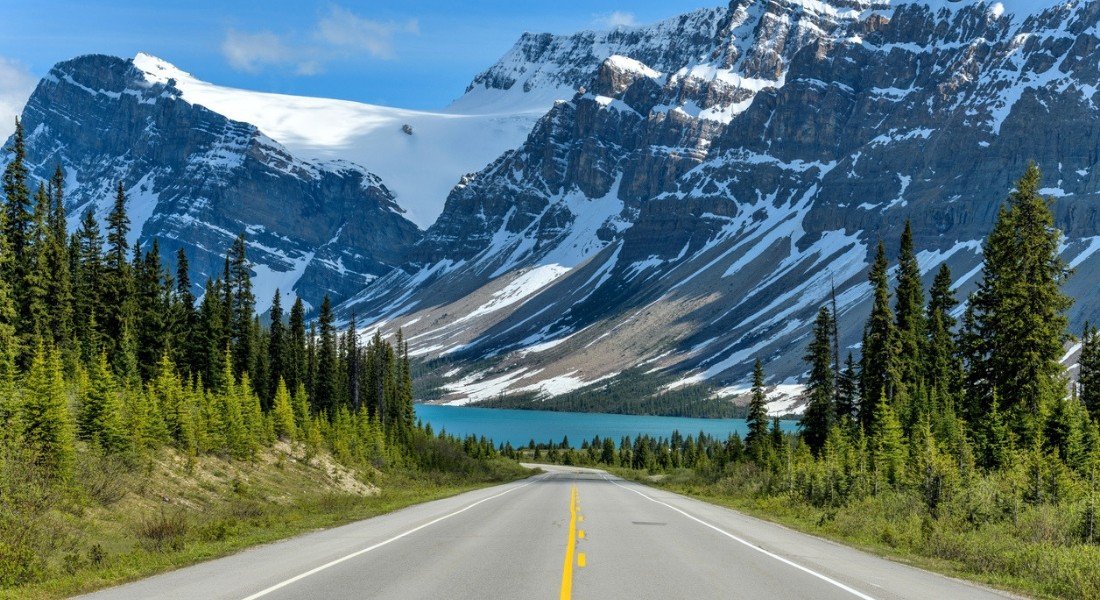
Finally, Bow Lake, with its mirror-like reflection of the surrounding mountains, is the perfect ending to your day's drive.
2. Sunshine Coast
- Section: Gibsons to Lund
- Region: Vancouver Island, British Columbia
- Distance: 180 km
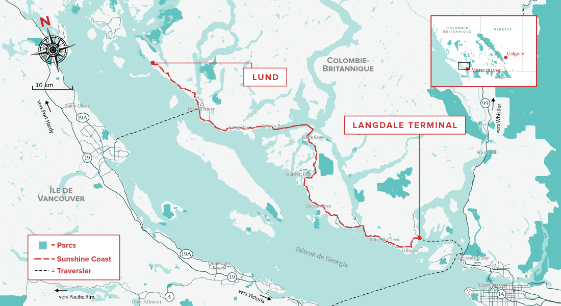
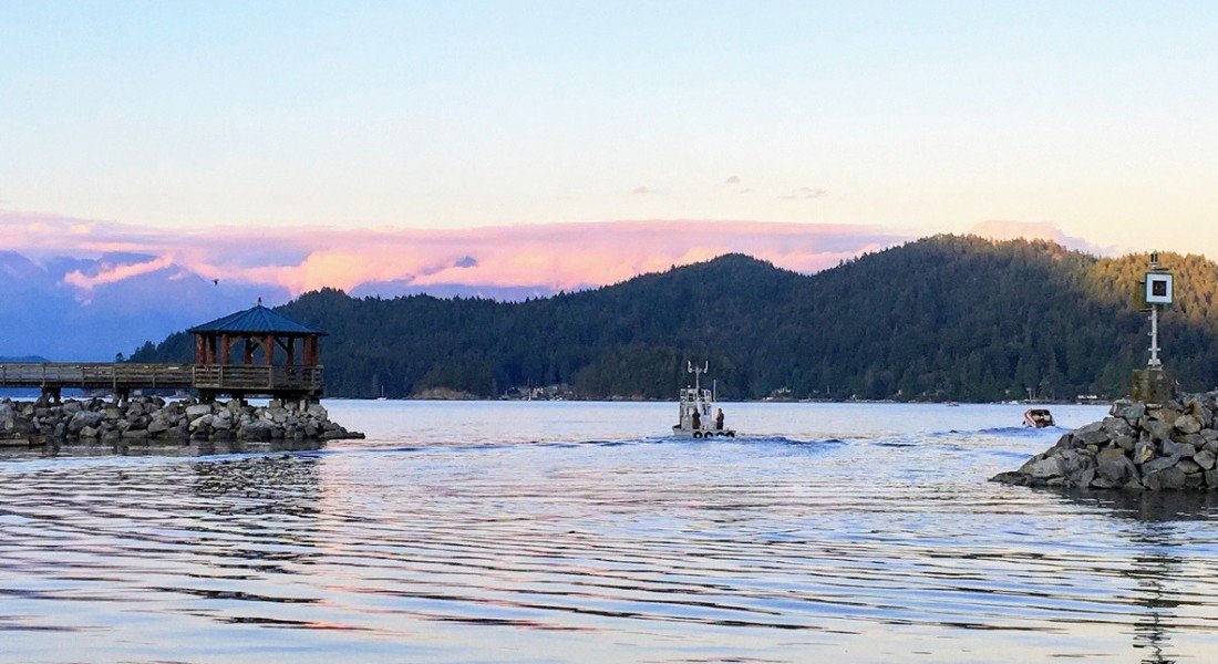
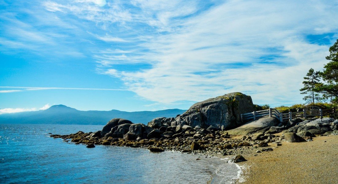
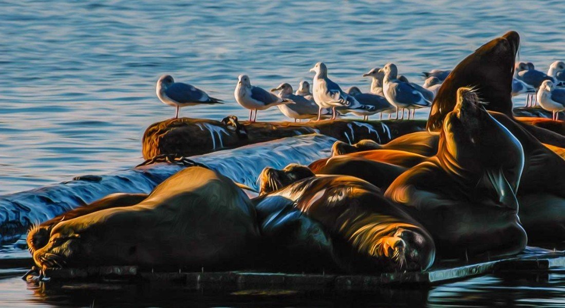
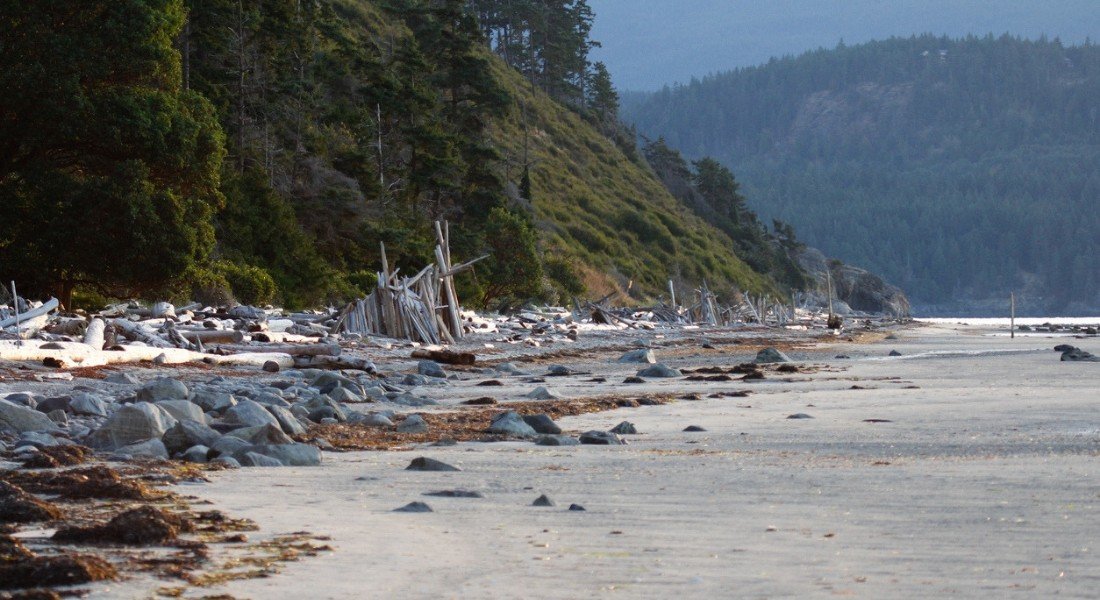
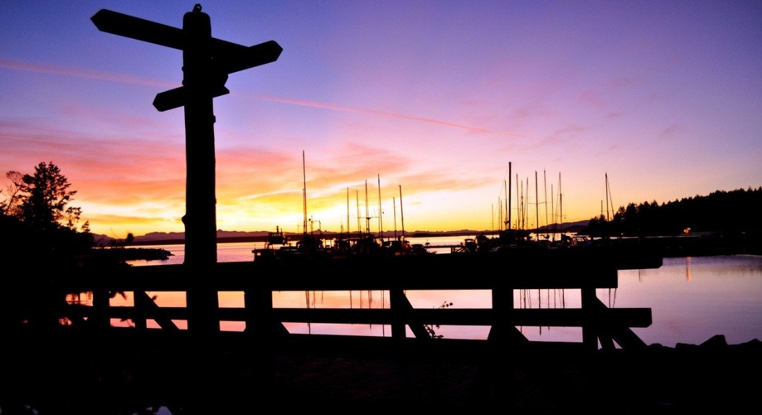


Just a short ferry ride from Vancouver, this picturesque highway follows the coast for 180 km to the quiet village of Lund through one of the sunniest parts of the province. The Sunshine Coast lives up to its name, making it an enticing destination for a road trip!
Visit Roberts Creek Provincial Park for a picnic, or keep going to the expansive Garden Bay Lake, a great family spot for a picnic lunch.
Once in Powell River, the sands of Palm Beach and Willingdon Beach are well worth stopping for a swim.
Charming villages
The coastal village of Gibsons is where you will want to stock up on fresh food and pick up some local handicrafts at the public market.
In Powell River, be sure to visit the Townsite Heritage District, a neighbourhood of unique historic buildings from the early 20th century.
The itinerary ends in the charming seaside village of Lund. If you want to prolong your adventure, you can take a water taxi from Lund to Savary Island, which has been dubbed the "Hawaii of the North" due to its white sandy beaches.
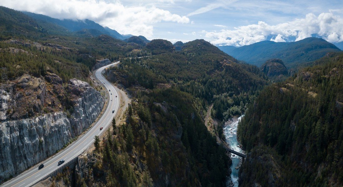
3. Sea-to-Sky Highway (Highway 99)
- Section: Vancouver to Pemberton
- Region: British Columbia
- Distance: 150 km
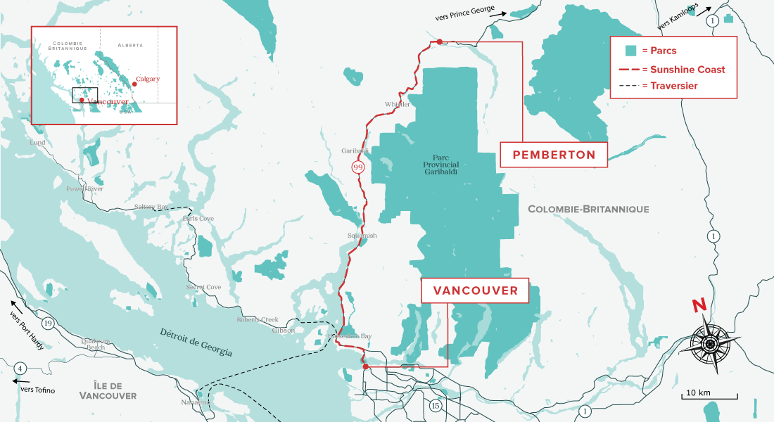
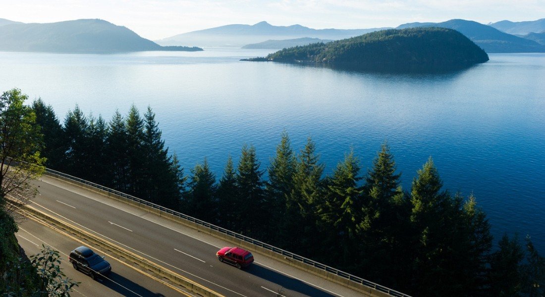
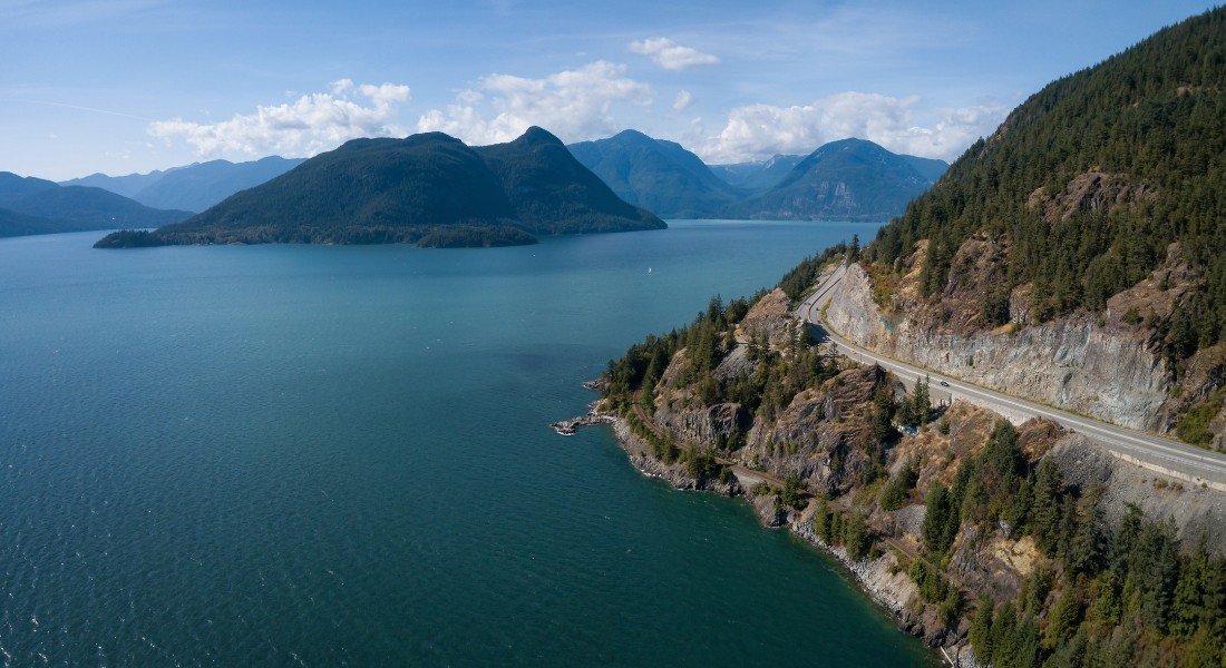


With a name like that, it should come as no surprise that this spectacular drive is one of the most beautiful in all of Canada.
From Vancouver to Pemberton, the road officially known as Highway 99 leads motorists through awe-inspiring west coast scenery.
Beginning in Vancouver at sea level and following the shore of Howe Sound, the route weaves deep into the Coast Mountains and then climbs through old-growth rainforests before reaching the tourist village of Whistler, perched at an altitude of more than 670 metres.
In addition to breathtaking views, this iconic Western Canada experience abounds in natural and cultural attractions. These include the Britannia Mine Museum National Historic Site, which offers guided tours of the mines.
High perched panoramas
Just a few minutes from the mines, make a stop at Shannon Falls, the third tallest waterfall in the province.
Don't miss the nearby Sea-to-Sky gondola, which will transport you to a height of more than 885 metres for sweeping views of Howe Sound.
Continue your route, taking a short break at Tantalus Lookout before continuing on to Whistler, a paradise for extreme sports. If you prefer to unwind, a visit to Scandinave Spa Whistler is a lovely way to end the day's exhilarating, discovery-filled adventure.
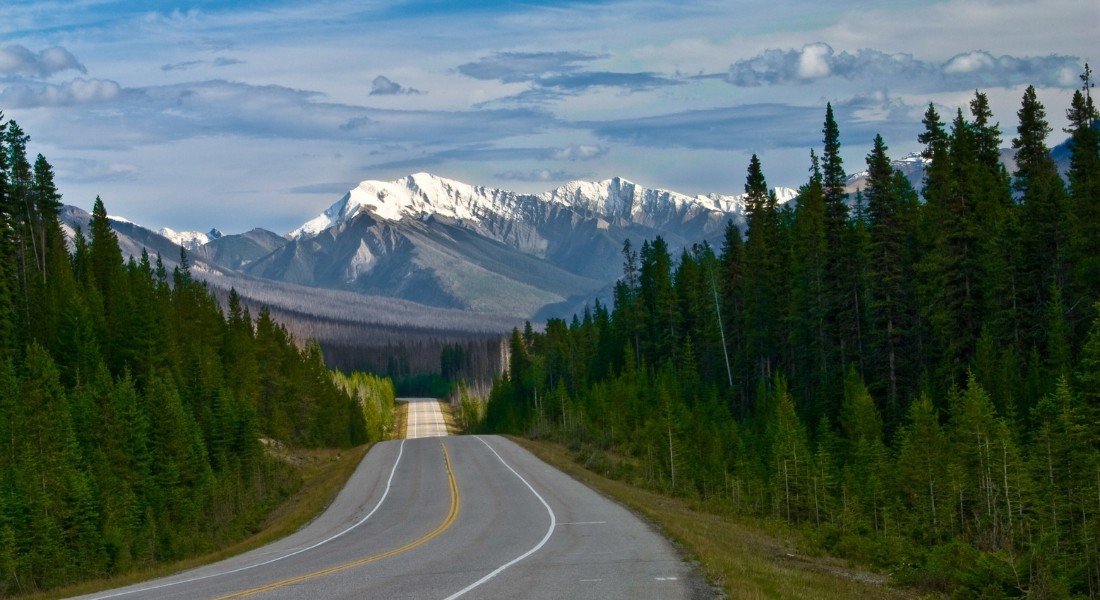
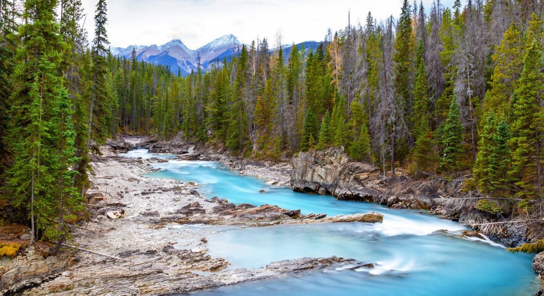
4. Banff-Windermere Highway
- Section: Castle Junction to Radium Hot Springs
- Region: Kootenay National Park, British Columbia
- Distance: 94 km
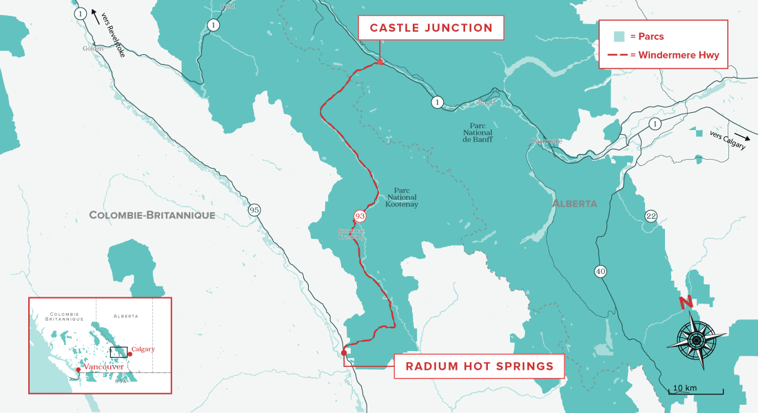


This scenic 94-kilometre highway lets you explore the diverse landscapes of Kootenay National Park, in the heart of a forest that is regenerating after a major forest fire.
Points of interest along the way include the Kootenay Valley Viewpoint, which provides breathtaking views of the Mitchell and Vermilion mountain ranges.
At the end of the drive, take the time to relax and unwind in the Radium Hot Springs pools, which are some of the best in the province.
Awe-inspiring short hikes
If you feel the need to stretch your legs, the short interpretive Fireweed Loop Trail tells the story of the 1968 Vermilion Pass Burn and the role it played.
Canyon Marble Trail is also popular with visitors with limited time who are looking for a quick hike. In just 15 minutes, you will find yourself at the top of a dramatic limestone gorge. Once there, don't hesitate to have your picture taken in one of the famous red chairs.
Before you go, be sure to download the Parks Canada Kootenay Guided Tour App. You will enjoy the benefits of a guided audio tour while taking in the sights at your own pace.
Similar articles
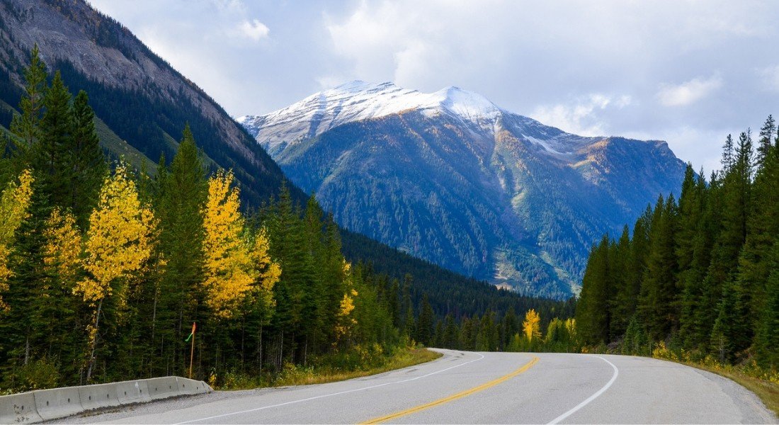
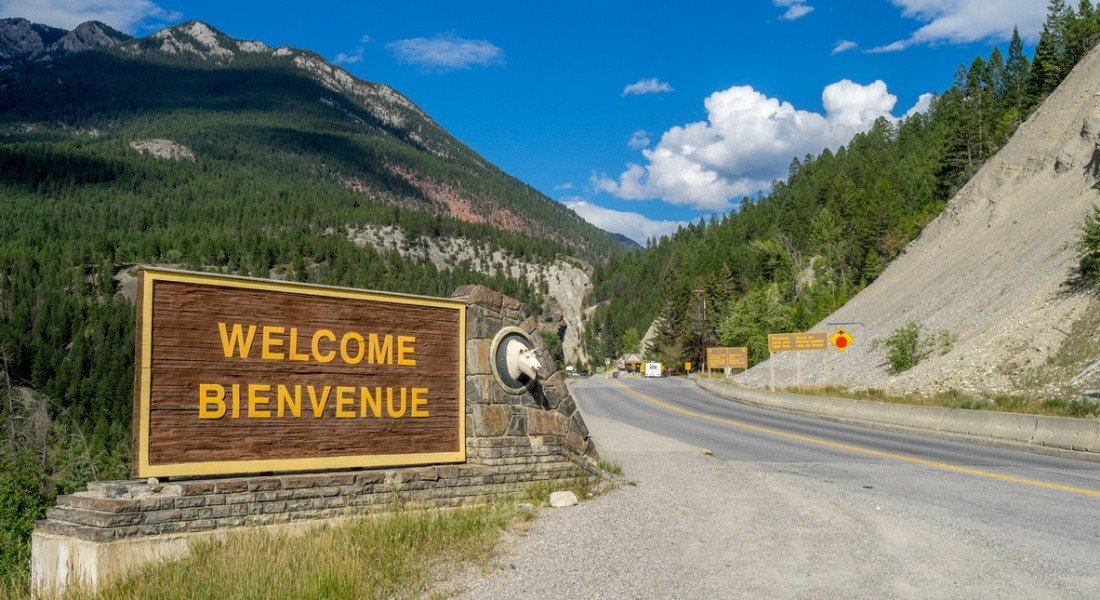
5. Yellowhead Highway (Highway 16)
- Section: Jasper to Prince George
- Region: Alberta and British Columbia
- Distance: 375 km
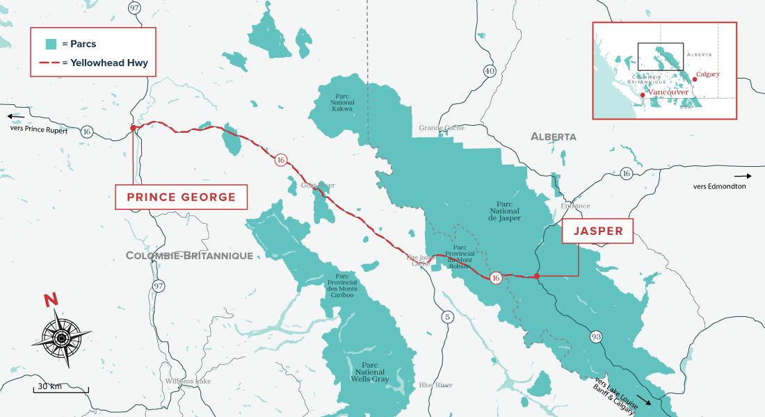
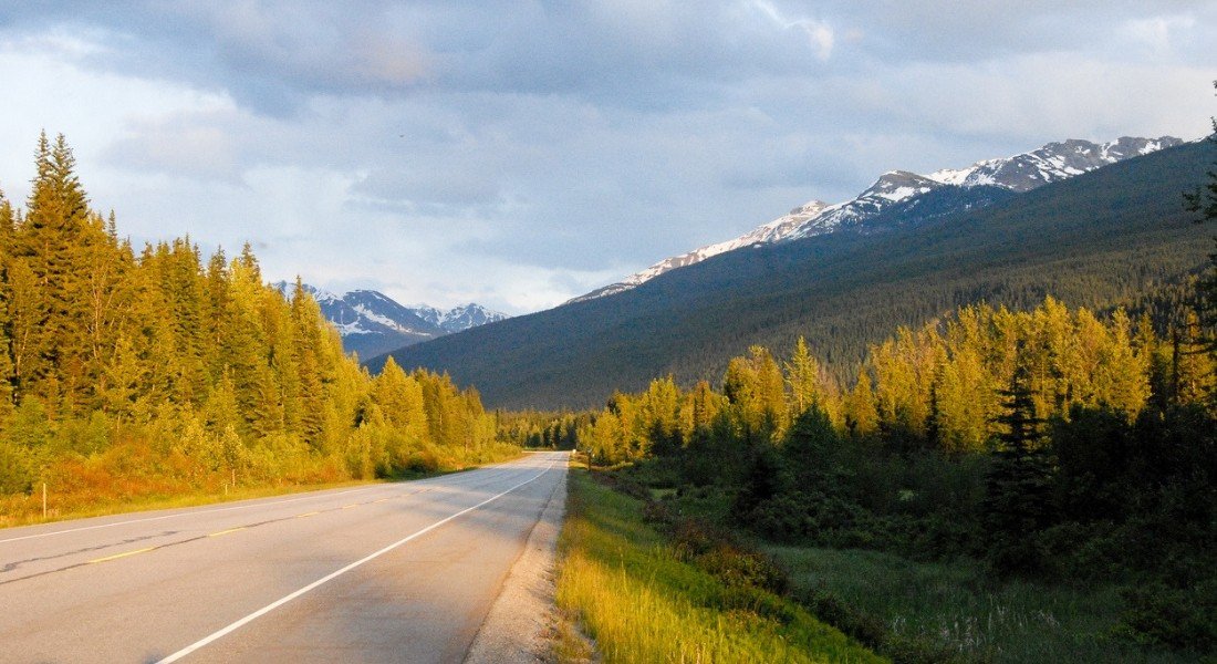


The Yellowhead Highway, which runs from east to west across the Prairie Provinces and Western Canada with their countless parks, is particularly impressive between Jasper and Prince George.
There are many viewing points along the way, offering incredible vistas of Canada's spectacular natural environment.
The Yellowhead Highway is also the departure point for a wide array of nature adventures: hiking, rafting, wildlife viewing excursions, and more.
Wildlife encounters
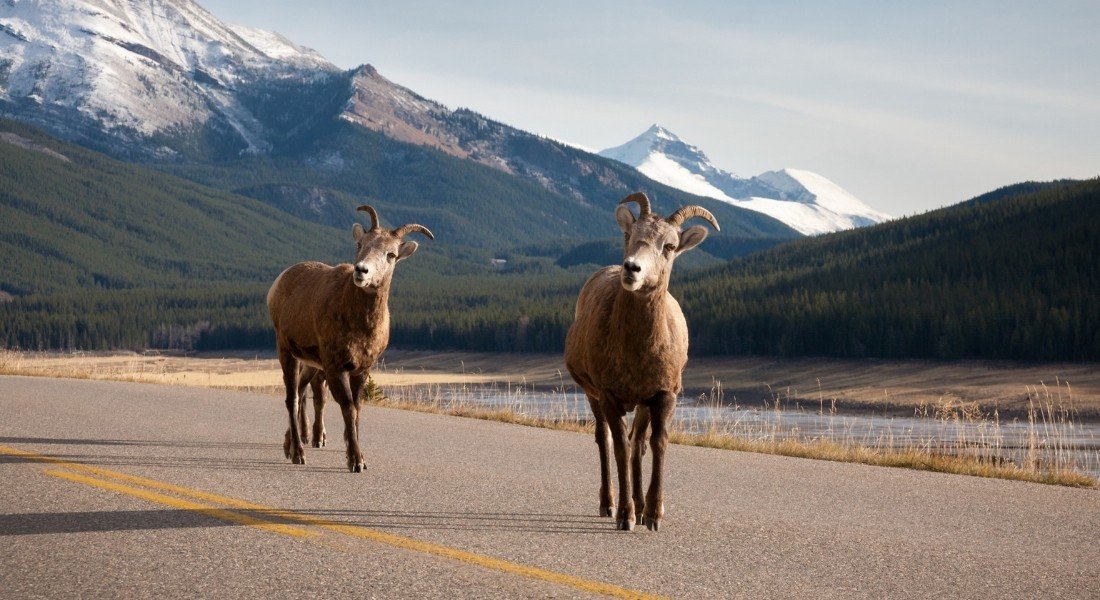
Between the picturesque townsite of Jasper and Mount Robson, you will drive through the heart of Jasper National Park, one of the last great wildlife ecosystems in the Canadian Rockies.
Be on the lookout, because you have a very good chance of seeing elk, bighorn sheep, deer or even a grizzly bear! Especially if you are on the road during the first two hours after sunrise.
About an hour east of Prince George, don't miss Ancient Forest Trail, where you can walk through a stand of enormous ancient cedar trees in a rare inland rainforest ecosystem.
6. Pacific Rim Highway (Highway 4)
- Section: Port Alberni to Tofino
- Region: Vancouver Island, British Columbia
- Distance: 130 km
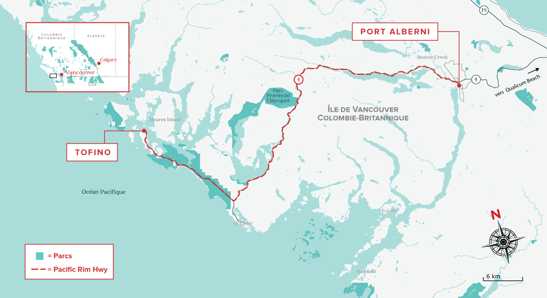
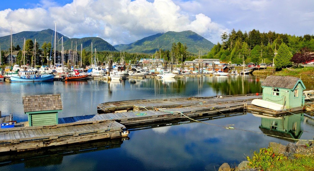
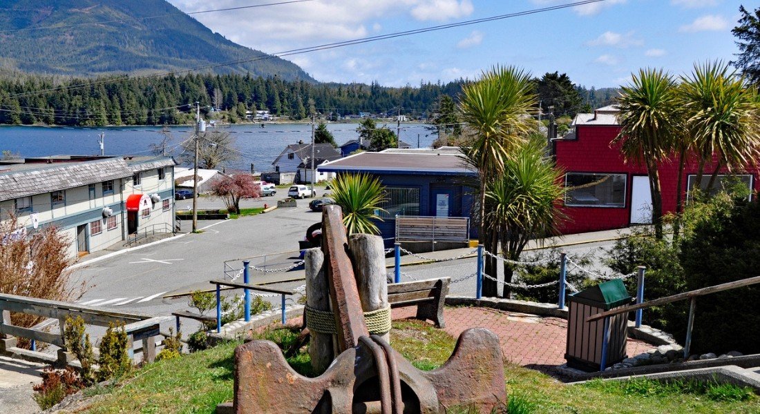
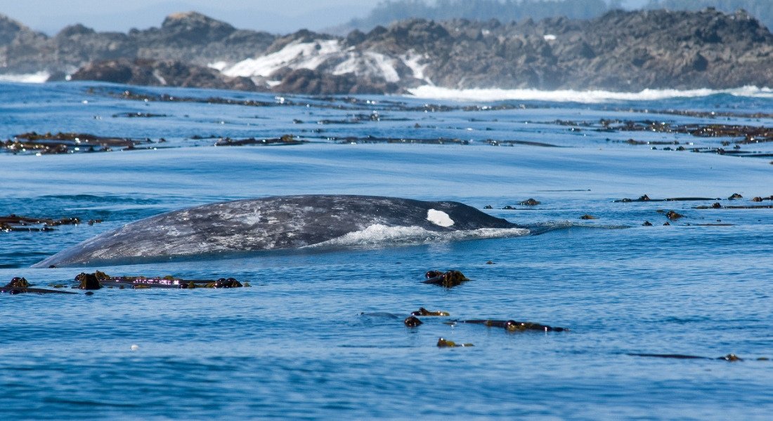


This scenic highway runs from east to west across Vancouver Island to Tofino. Known as "Canada's surfing capital", Tofino is also a charming fishing village with many local craft boutiques and Native art galleries.
The Pacific Rim Highway winds through the rugged mountains of the Mackenzie Range and then follows the Pacific coast. It begins in Port Alberni, and passes through stunning Canadian wilderness landscapes of mountains, forests, lakes and beaches.
Despite the more than one million visitors who travel this road every year, it still retains its wild, unspoiled beauty.
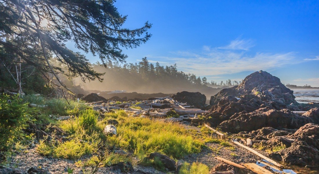
Surfers' paradise
Once you reach Tofino, be sure to take a surf lesson, as the area is a surf mecca ! Then, spend the night in the charming small town of Ucluelet.
Before starting back, spend some time relaxing on magnificent Long Beach and exploring the many oceanfront trails.
7. Maligne Lake Road
- Section: Jasper to Maligne Lake
- Region: Jasper National Park, Alberta
- Distance: 46 km
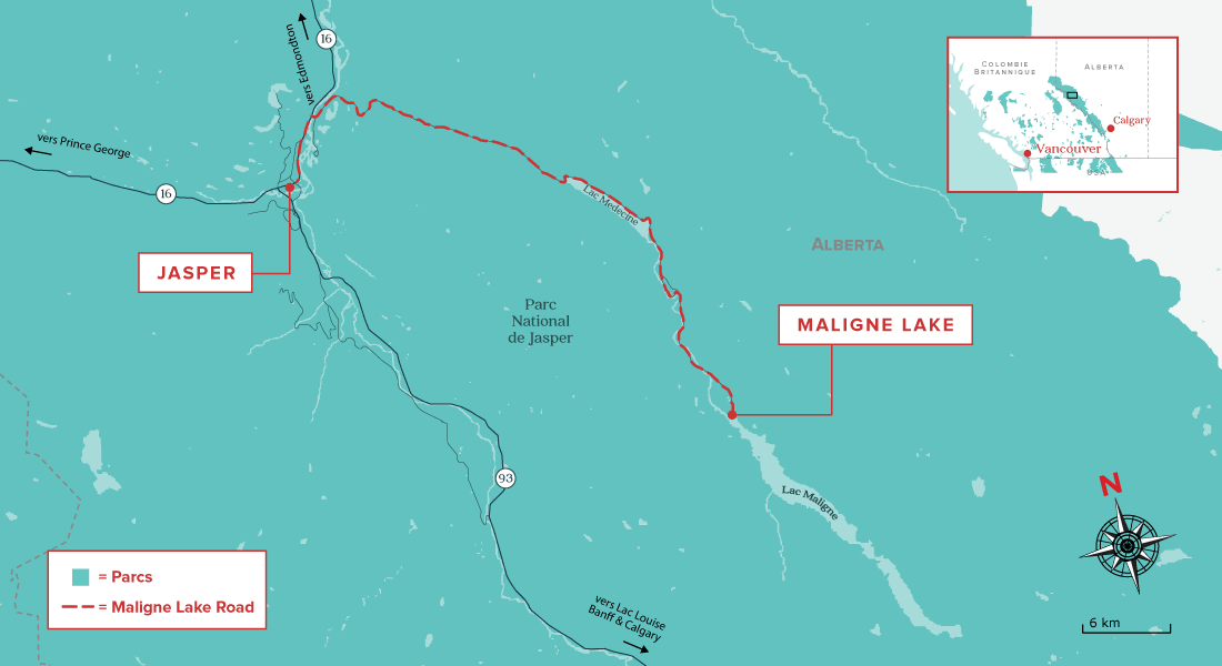


This winding 46-kilometer road was built along the glacier valley running between two majestic mountain ranges and offers many opportunities to spot wildlife. If possible, plan your drive for early morning, as you will have a greater chance of seeing wildlife.
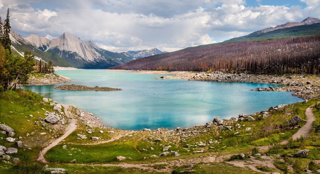
Along the way, stop to admire peaceful Medicine Lake and the Athabasca River.
The stars of the Rockies
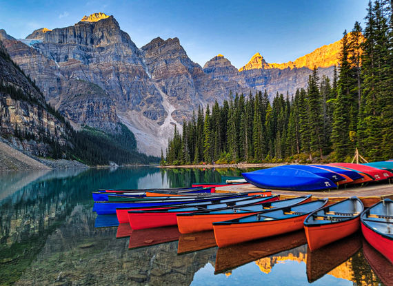
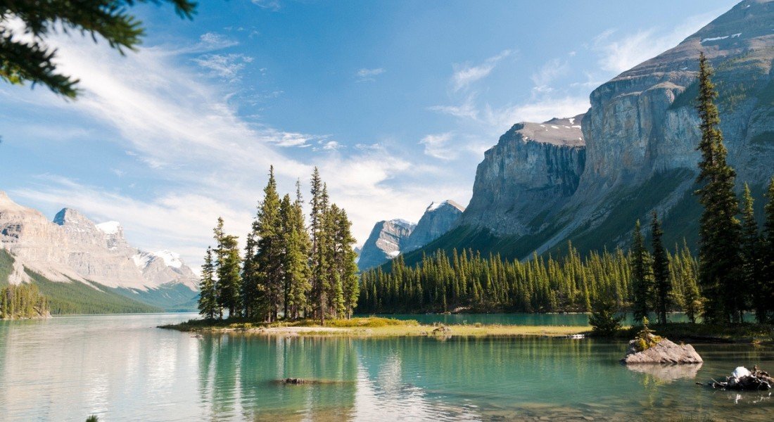
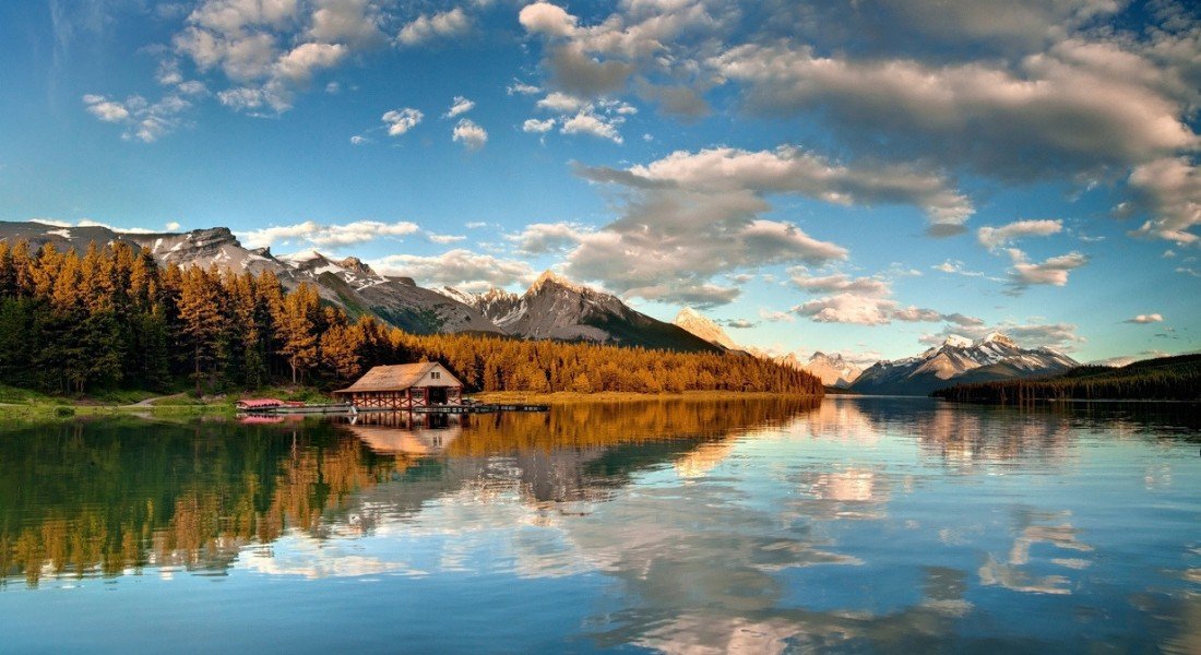
Maligne Lake Road starts near the town of Jasper and provides access to the turquoise waters of the famous Maligne Lake.
Surrounded by snow-capped mountains, this glacier-fed lake is the most popular tourist attraction in Jasper National Park.
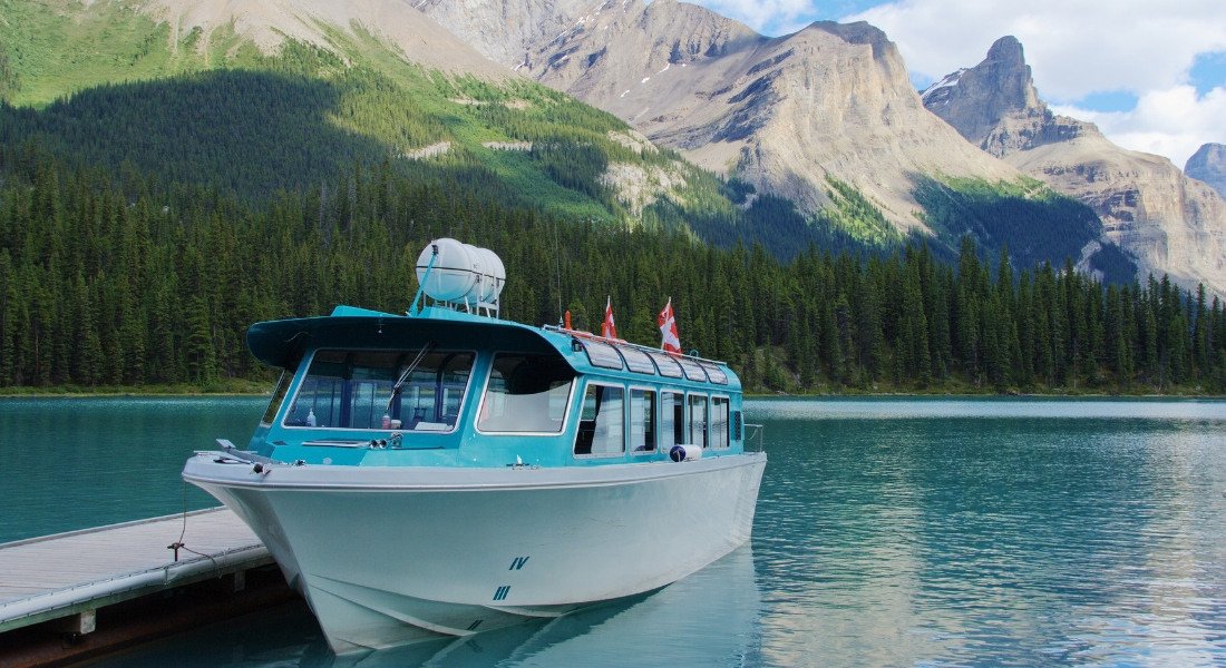
You can admire it from the shore, or take a boat cruise to Spirit Island, one of the most photographed landscapes in all of Canada.
Be sure to fill your gas tank before setting out, because there are no service stations along the route.
8. Dinosaur Trail
- Section: Routes 838,837 and 575
- Region: Drumheller, Alberta
- Distance: 48 km
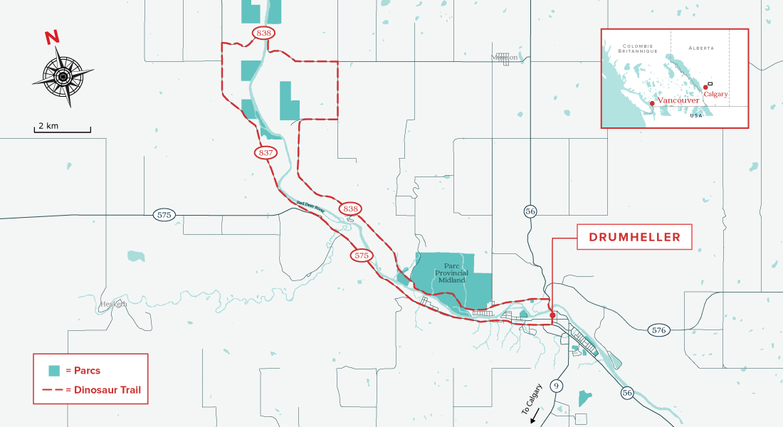
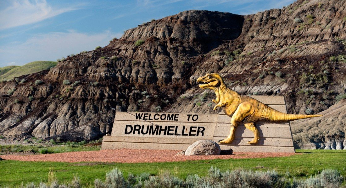
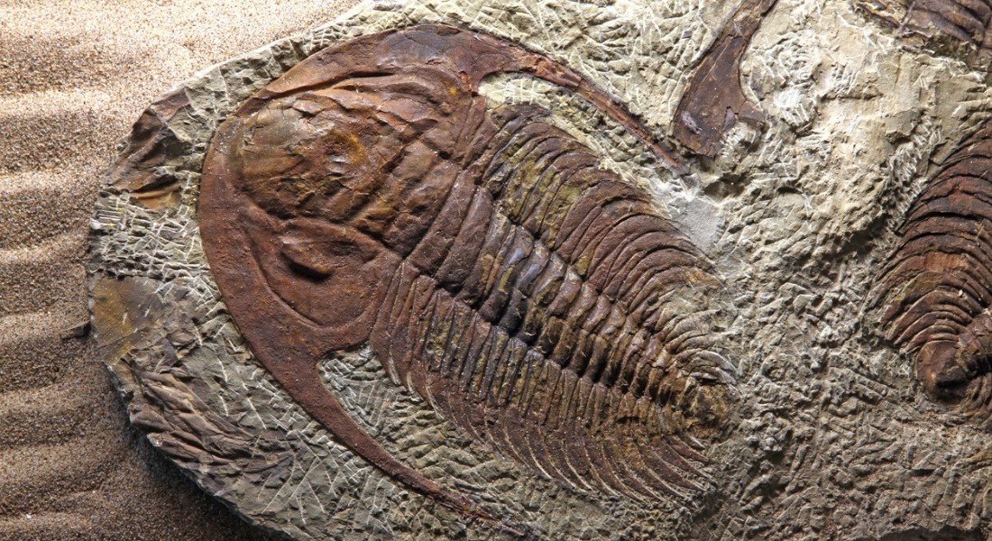


Millions of years ago, dinosaurs flourished in this part of Alberta. Today, the area is known as the dinosaur capital of the world because of the high concentration of fossils found there.
This circular tourist route combines sections of Highways 838,837 and 575, forming a 48-kilometre loop along the Red Deer River.
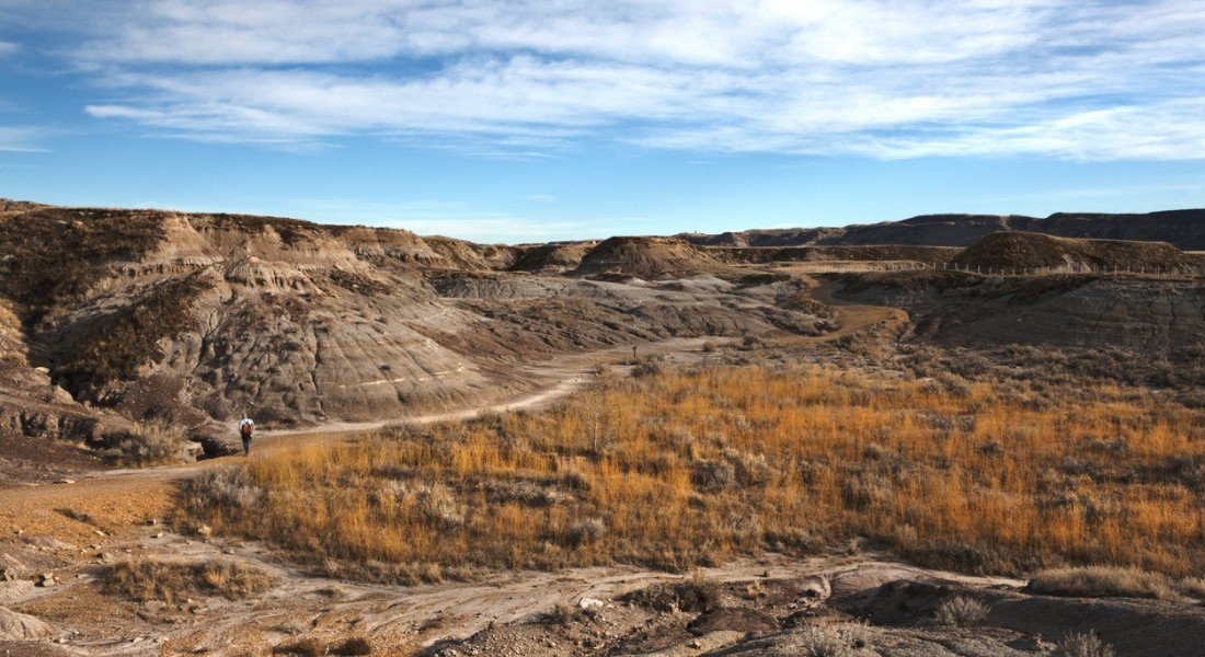
Deserts and dinosaurs
On this journey, you have to stop in Drumheller.
Pay a visit to the Royal Tyrell Museum, home to one of the largest collections of dinosaur skeletons in the world, which is sure to impress visitors both young and old alike.
Located in the Canadian Badlands, the drive takes visitors through a universe of arid, barren landscapes, in stark contrast with the pine forests and snowy peaks of the Rockies.
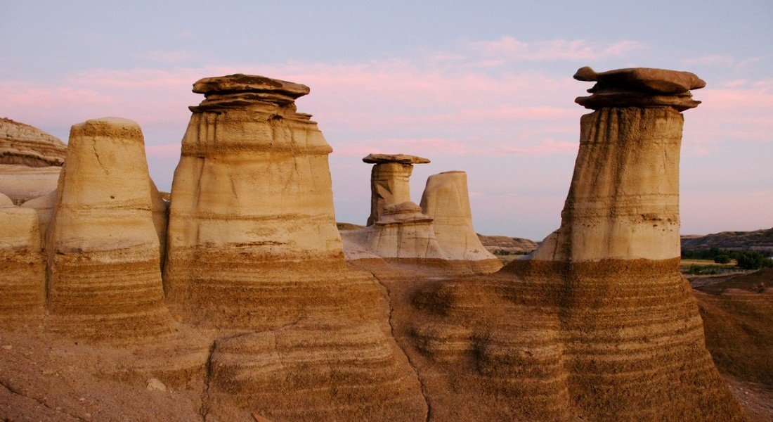
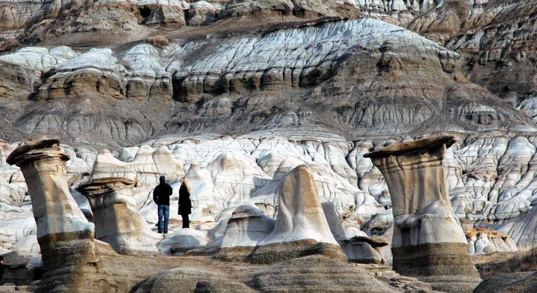
The region abounds with canyons, buttes, mesas, hoodoos ("fairy chimneys") and cactuses that would not be out of place in the American Far West !
Impressive panoramas
Your route will take you past Horsethief Canyon, where you can enjoy spectacular views of the valley below.
Don't miss the Orkney Lookout with its superb view of the river valley.
Time permitting, take a drive along the 25-kilometre Hoodoos Trail for a good look at the impressive sandstone formations.
9. Trans-Canada Highway (Highway 1)
- Section: Revelstoke to Golden
- Region: Glacier National Park and Mount Revelstoke National Park, British Columbia
- Distance: 148 km
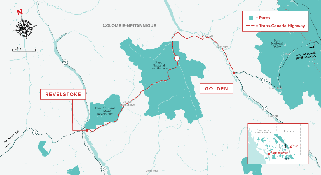
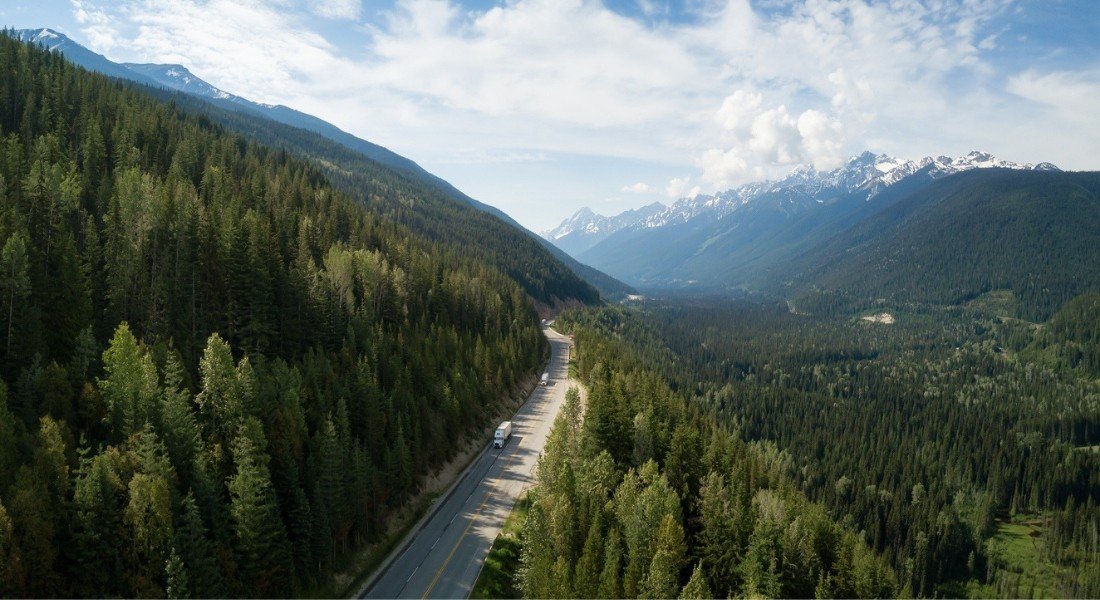


The stretch of the Trans-Canada Highway between Revelstoke and Golden in British Columbia is simply breathtaking.
It passes through the heart of Glacier National Park, taking Rogers Pass through the Selkirk Mountains and offering travellers one of the most beautiful alpine vistas in the province.
Note: the parkway is narrow and has tight switchbacks. Vehicles over 7.9 metres in length are not permitted.
Steeped in history
Glacier National Park is not only beautiful, it is also rich in history.
From 1885 to 1917, Roger Pass was used by the Canadian Pacific Railway to connect the nation from coast to coast. Before the discovery of this pass, the Selkirk Mountains were considered an impenetrable barrier, making this route through the mountains virtually impossible.
To learn more about this national historic site, visit the Rogers Pass Discovery Centre in Glacier National Park.
Breathtaking meadows
In addition to its important cultural and natural significance, the 148-km drive offers another spectacular attraction: Mount Revelstoke National Park, 263 km2 of contrasting landscapes featuring steep rugged mountains, rainforests, glaciers and lush alpine meadows.
One of the major attractions in Mount Revelstoke National Park is the Meadows in the Sky Parkway, a scenic 26-kilometre paved mountain road leading up to the summit of Mount Revelstoke and Balsam Lake. The best time to visit is in August, when the meadows bloom with a spectacular carpet of wildflowers.
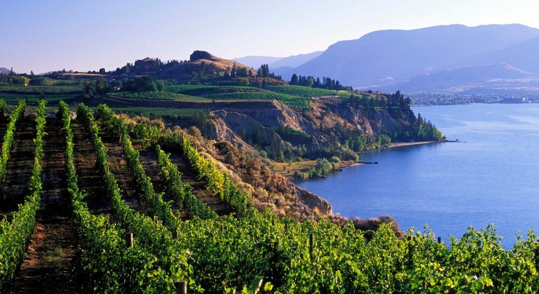
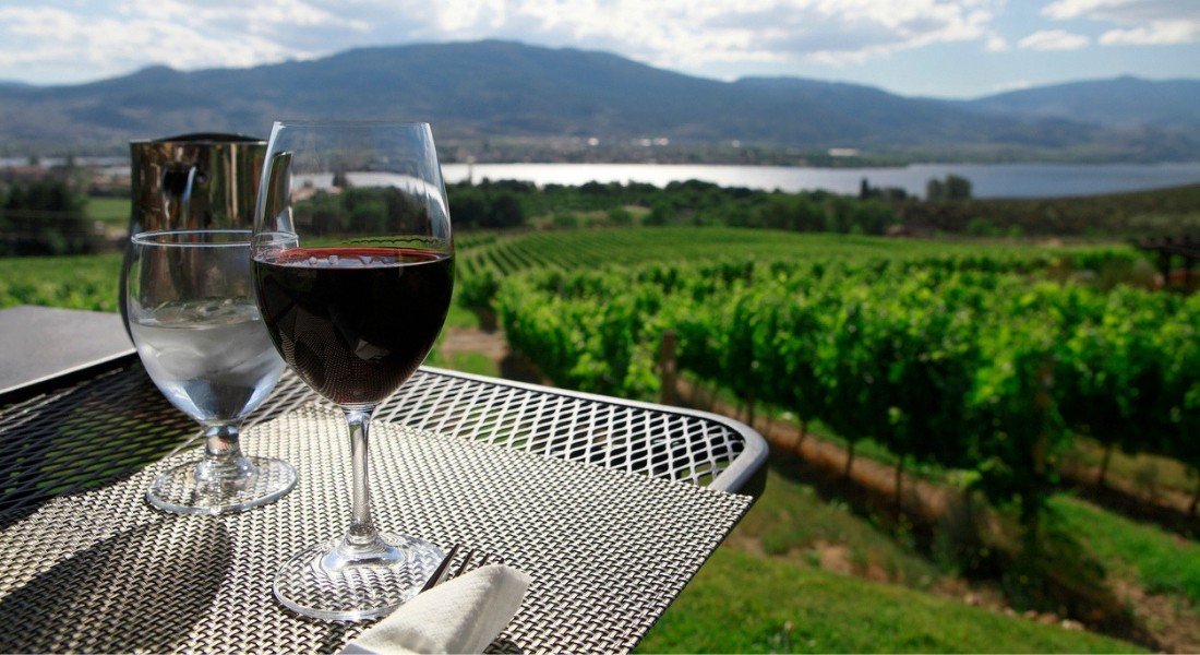
10. Okanagan Highway (Highway 97)
- Section: Vernon to Osoyoos
- Region: Okanagan Valley, British Columbia
- Distance: 170 km
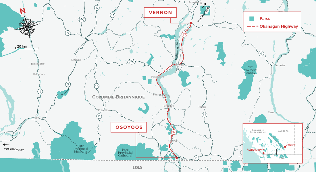
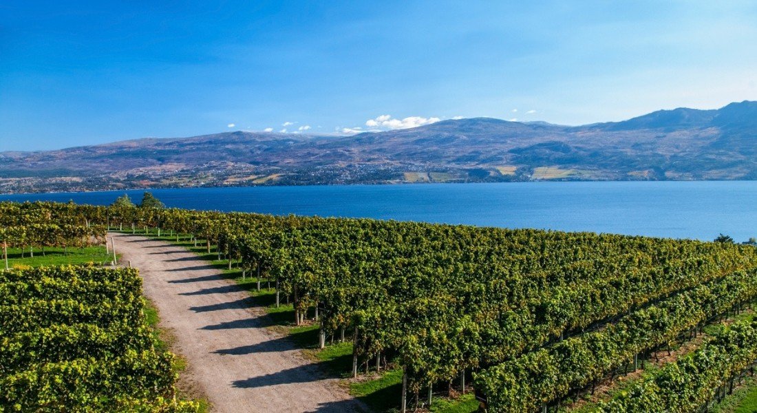
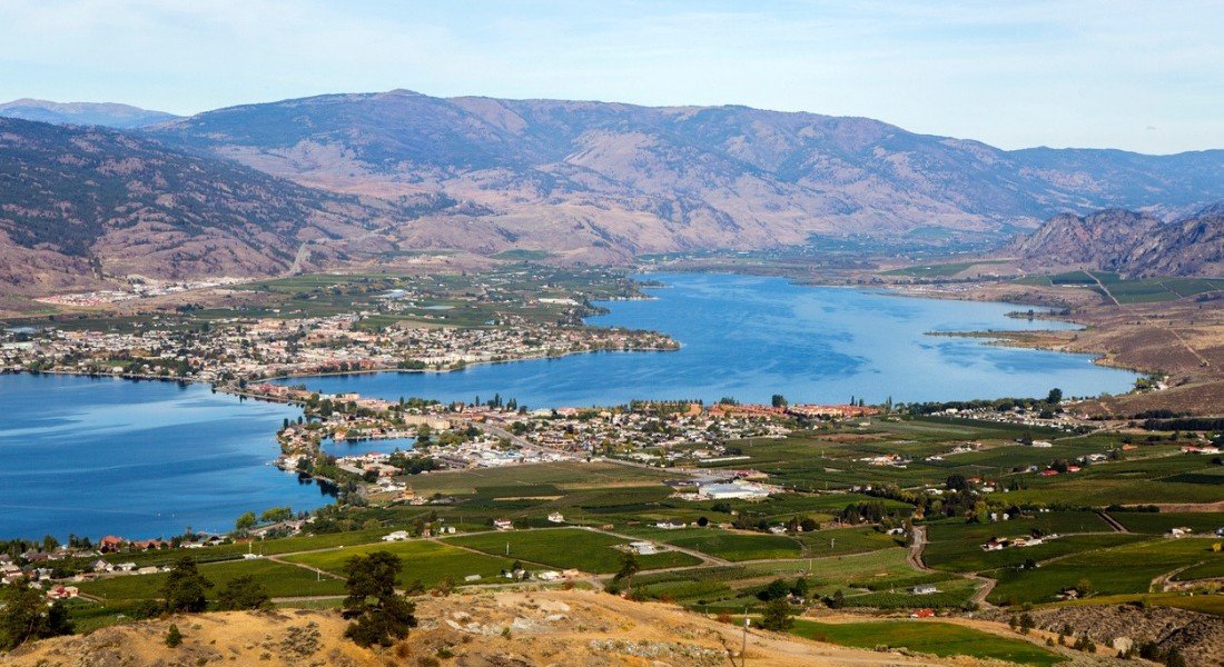


Highway 97 spans the United States and Canada, running north through British Columbia from the border near Osoyoos.
One of the most scenic sections of this international highway is that between Vernon and Osoyoos. For more than 170 km, the route offers travellers a series of hilly landscapes dotted with lakes as it winds through the sunny Okanagan Valley.
As opportunities for swimming are rare during a Western Canada road trip, don't miss going for a dip in Osoyoos Lake, the warmest lake in Canada.
And while you're there, make the short detour to pay a visit to the Nk’Mip Desert Cultural Centre, where you will discover a unique desert ecosystem and the rich culture of the Okanagan people.
Wining and dining
The Okanagan Valley, wine capital of Canada, boasts almost 200 licensed wineries.
Be sure to visit a few of these along the way: you are sure to be pleasantly surprised by the quality of the wines !
The vineyards will often offer a pairing with regional goodies.
The charming small town of Penticton is also an enjoyable place to stop for lunch.
And that's it for my top 10 scenic routes in Western Canada.
Which one will you venture on during your next road trip in the West?
Let me know in the comments section below.

About the author
![Karolane Lessard]()
Karolane Lessard
An enthusiast of both our vibrant cities & great oudoors, my life revolves around travel & adventure. It's a no brainer that I have to share the wonders & secrets of my neck of the woods with other travelling souls. Enjoy the journey!

An enthusiast of both our vibrant cities & great oudoors, my life revolves around travel & adventure. It's a no brainer that I have to share the wonders & secrets of my neck of the woods with other travelling souls. Enjoy the journey!


Leave a comment
Répondre à: -
delete my replyYour e-mail address will not be shared
16 comments