Hiking the Acropole-des-Draveurs trail
Anyone who knows me knows that my love for the Acropole-des-Draveurs Trail in Charlevoix is unconditional.
This jewel of La Belle Province is a must for all hiking enthusiasts planning a road trip in Quebec.
However, this hike requires a good level of fitness and, above all, a bit of preparation.
Here's how to prepare to climb the Acropole-des-Draveurs.
What is the Acropole-des-Draveurs trail?

Made up of 3 distinct summits, the Acropole-des-Draveurs is one of the most impressive trails in the province, but also one of the most physically demanding with an elevation gain of more than 800 metres.
Trail characteristics
Distance: 10.4 kilometres (to the 1st summit) | 11.2 kilometres (to the 3rd summit)
Time: Between 4 and 6 hours
Altitude: 1,048 metres
Elevation gain: 800 metres
Level: Difficult
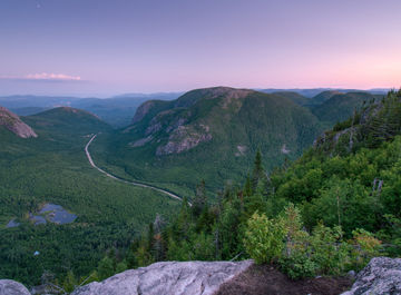
The rock faces in Hautes-Gorges-de-la-Rivière-Malbaie National Park are among the highest in Canada east of the Rockies.
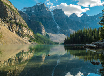
The first summit of the Acropole-des-Draveurs definitely offers the best views, with a dizzying panorama of the Malbaie River valley and surrounding mountains for hikers who dare to take on the challenge.
One of the most beautiful landscapes in Quebec awaits you.
Geographic location
The Acropole-des-Draveurs Trail is located in Hautes-Gorges-de-la-Rivière-Malbaie National Park, in the magnificent Charlevoix region.
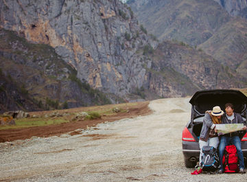
By car, it will take:
 from Montreal: +/- 5 hours
from Quebec City: +/- 2 hours
from Tadoussac: +/- 2 hours
Via Route 138, take Rue Principale through the picturesque village of Saint-Aimé-des-Lacs.
From there, simply follow the signs to the park.
Access to the trail

Once in the park, leave your vehicle in the visitor parking lot at the Félix-Antoine-Savard Discovery and Visitor Centre.
In high season, Sépaq offers hikers a continuous shuttle service, free of charge.
When the shuttle is in operation, all visitors must use it to reach the trail.
If you are camping in the Pin-Blanc sector, you can take the shuttle from there.
Rates
All visitors over the age of 18 must pay an entrance fee of $8.50.
Access is free for younger visitors.
Level of difficulty of the Acropole-des-Draveurs Trail

Developed by Sépaq, this trail is one of the most challenging in Quebec, because of its rapid elevation gain over such a short distance.
The trail surface is uneven and punctuated by imposing stone steps.
While the climb is difficult, some people find the descent even more challenging.
If you have knee problems, I would strongly advise against attempting this trail.
Please note that the trail can be done by children who are used to walking long distances. But if you're looking for easy family hiking trails in Quebec, this isn't your best option 
Just use your good judgement.
Acropole-des-Draveurs: kilometre by kilometre

For this article, I had to sacrifice myself and take off for a weekend in Charlevoix, doing the hike for the umpteenth time. 
For information purposes, I timed my ascent.
The point isn't to compare your time with mine, but rather to give you an idea of the level of difficulty of each kilometre.
All along the trail, you'll find signs indicating the distance covered.
Kilometre 1
The first kilometre is demanding. You'll have to adapt to the stone steps and find your own pace.
In a few places, you'll come across small waterfalls. Take the opportunity to cool off.
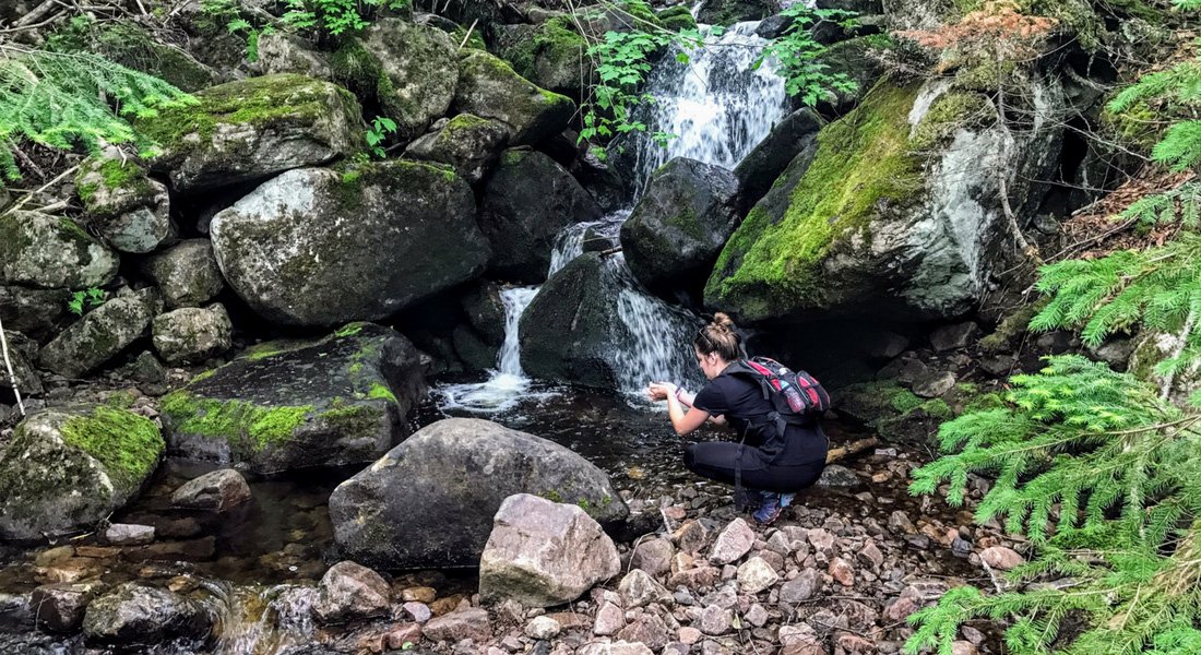
At 0.7 km, there's a rest stop where you can catch your breath and enjoy the view. At this point, you'll be at an altitude of 300 metres.
 My time: 27 minutes
Kilometre 2
The second kilometre is very tough. The climb is steady, without a break.
Go at your own pace: you've got all day!
My time: 33 minutes
Kilometre 3
Finally! A bit of a break!
The worst is now behind you. The third kilometre is quite a bit easier than the previous 2.
The climb is much less steep. Take the opportunity to get your breath back.

You'll find a dry toilet between kilometres 2.5 and 3. Be sure to close the door properly on your way out, as porcupines have been known to leave a few surprises inside.
Note that this is the only toilet along the trail.
Just opposite the toilet, you'll find an observation point and an interpretation panel.
My time: 17 minutes (half as long as the first 2 kilometres!)
Kilometre 4
And off we go again! The climb continues, over rocks like at the start.
Personally, I find this section to be the most mentally challenging. You start looking forward to reaching the famous summit.
At least, I certainly was!
When you finally reach the distance marker, you'll find a sign posted to give you a little encouragement.
My time: 26 minutes
Kilometre 5
A few minutes after kilometre 4, you'll reach the first Acropole-des-Draveurs summit.
Once there, take time to savour your achievement and admire the panoramic view that lies before you. It's breathtaking!

If you decide to stop there, you probably won't see the kilometre 5 marker, which is a few minutes further on.
My time to the 1st summit: 6 minutes
If you have the strength to keep going to the third summit, allow +/- 20 minutes.

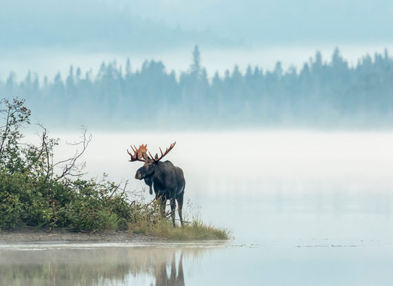
Keep your eyes peeled - some hikers have spotted caribou on this stretch of trail.
Once you've reached the end of the trail, your ascent will end with a beautiful view of two lakes.
Whichever summit you decide to stop at, you'll have risen to the challenge!
The descent
As Edward Murphy would say, "what goes up, must come down".
You'll have to retrace your steps.
Go at your own pace and be careful, especially if the rocks are wet.
If you're sporty and the weather permits, you can jog a little when it's not too steep. Personally, I find it easier on the knees.
In any event, the important thing is to respect your body's limits and, above all, to have fun!
Practical advice

- In high season, the trail is quite busy. Arrive early in the morning!
- If you're used to hiking with walking sticks, bring them along!
- Bring Watkins mosquito repellant.
- Bring at least 2 litres of water per person and snacks.
- Bring warm clothing, even in warm weather. It's usually between 5 and 10 degrees cooler at the summit. You can also bring a spare shirt, because I guarantee you'll be sweating.
- Wear walking shoes, preferably with ankle support. Make sure your shoes have thick soles.
- Have fun and encourage your partners and the other hikers who cross your path.
And that's it!
Are you planning to do this hike during your next trip to Quebec?
If you have any questions and/or suggestions, feel free to share them in the comments below!

About the author
![Karine Beaudin]()
Karine Beaudin
An enthusiast of our great outdoors and a travel advisor within the Authentik team, it’s with great pride that I share our country’s best-kept secrets and hidden treasures with the rest of the world. Welcome to our neck of the woods !

An enthusiast of our great outdoors and a travel advisor within the Authentik team, it’s with great pride that I share our country’s best-kept secrets and hidden treasures with the rest of the world. Welcome to our neck of the woods !


Leave a comment
Répondre à: -
delete my replyYour e-mail address will not be shared
14 comments